Wild Atlantic Way Guide: Ireland's 2,500 km Coastal Route
Plan your trip
The Wild Atlantic Way is a 2,500 km marked driving route along Ireland’s entire Atlantic coast, from Malin Head in County Donegal (the most northerly point of mainland Ireland) to Mizen Head in County Cork (the most southerly). Launched by Tourism Ireland in 2014, it functions less as a single route and more as a framework for accessing one of Europe’s most dramatic coastlines — a succession of sea cliffs, headlands, peninsulas, and offshore islands beaten by the full force of the North Atlantic.
No visitor drives the entire route in one trip. The most visited sections, roughly organized by region, are covered here.
The Cliffs of Moher (County Clare)
120 m–214 m high | 8 km of coastline | Entry: €8
The most visited natural attraction in Ireland — vertical sea cliffs reaching 214m at the highest point, extending 8 km along the Clare coast. The Cliffs of Moher Visitor Experience (an underground facility built into the cliff face) handles the crowds with some dignity; the cliffs themselves, viewed from the official path or from O’Brien’s Tower, require no interpretation.
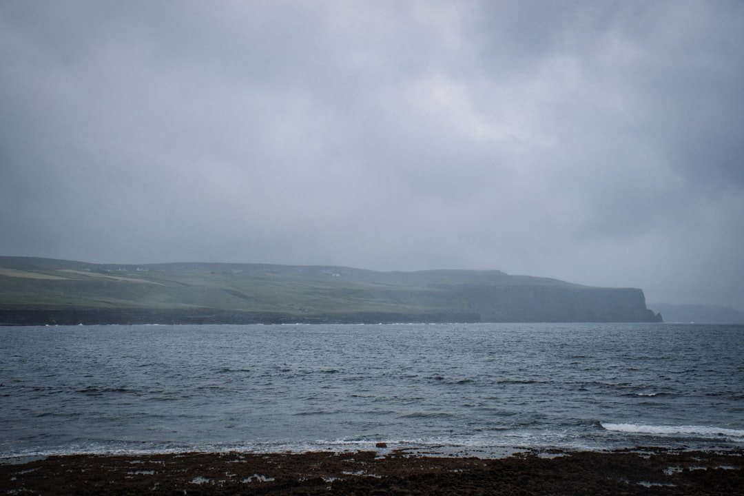
The honest assessment: On a clear day, the cliffs are extraordinary and the views to the Aran Islands are excellent. On a misty or foggy day (common), the cliff edges disappear into cloud 50m below the viewing path and the experience is much reduced. Check the weather forecast and, if possible, choose a clear morning.
Crowds: The Cliffs of Moher receive over 1.5 million visitors annually. July–August can produce significant queues. Early morning (before 9 AM) or late evening (the site is open until 9 PM in summer) reduces the crowd substantially.
Beyond the visitor center: The cliff walk extends south toward Hag’s Head (2.5 km, no barriers, vertigo-inducing) and north toward Doolin — the less visited sections have equivalent scenery with few people.
The Burren (County Clare)
Immediately inland from the Cliffs of Moher
One of the most unusual landscapes in Ireland — a limestone karst plateau of approximately 250 km² where the grey rock pavement (called “clint and grike” for the flat surfaces and fissures) supports a paradoxical combination of Alpine, Mediterranean, and Arctic plant species. The botanical reason: the warm Gulf Stream moderating temperatures combined with the bare limestone’s heat retention in the fissures, creating micro-climates that shouldn’t coexist.
The Burren in May is the best time botanically — mountain avens, gentians, orchids, and bloody cranesbills flowering across the rock. The Burren Food Trail connects local producers; the Burren Smokehouse at Lisdoonvarna is a useful stop.
Connemara (County Galway)
West of Galway city, on the N59
The defining Wild Atlantic Way landscape — blanket bog, quartzite mountains, island-studded coastline, and the Gaeltacht (Irish-speaking) culture that survives most actively here. The drive from Galway through Clifden to Leenane and on to Westport covers the best of it.
Key stops:
- Kylemore Abbey: Gothic Revival castle in a lake valley, now a Benedictine convent. Gardens and café open to visitors. Expensive (€15 entry) for what it is, but the setting is extraordinary.
- Sky Road, Clifden: A 12 km circular road from Clifden around the coastal headland — the best Connemara coast views, with Clifden Bay and the Atlantic beyond.
- Killary Harbour: Ireland’s only fjord — a 16 km glacier-carved inlet. The narrow coast road on the southern shore is one of the most dramatic drives in Connemara.
- Mweelrea Mountain (814m, County Mayo): The highest peak in Connacht — visible from Killary. A significant but non-technical hike requiring a full day.
The Dingle Peninsula (County Kerry)
Southwest of Tralee | Most spectacular tip of the Ring of Kerry extension
Fifteen km west of the Ring of Kerry road, the Dingle Peninsula juts into the Atlantic on a scale that produces the most dramatic western headlands in Ireland. The Slea Head Drive (50 km loop from Dingle town) is the standard route.
Slea Head Drive:
- Gallarus Oratory: An early Christian stone oratory (approximately 8th century), built in dry stone corbel technique, still completely waterproof after 1,200 years. Free access, car park. One of the finest examples of early Irish Christian architecture.
- Slea Head viewpoint: At the tip of the peninsula, the Blasket Islands (abandoned in 1953, now a national park) are visible offshore. The Great Blasket had a literary community — Tomás Ó Criomhthain’s An tOileánach (The Islandman) and Peig Sayers’ autobiography are the most celebrated examples of an Blasket literature.
- Beehive huts (Clochán): Dry-stone corbelled huts dating from the early medieval period (some possibly Bronze Age foundations). Several accessible sites along the Slea Head road.
Dingle town: The main service center of the peninsula — good seafood restaurants (Out of the Blue is the most acclaimed; no menu, depends entirely on the day’s catch), a Traditional Music pub (An Droichead Beag on Main Street), and a resident bottlenose dolphin (Fungie) who has inhabited Dingle harbor since 1983. Boat trips to see Fungie: €15.
Slieve League (County Donegal)
Near Carrick, Donegal | Free access
The highest sea cliffs in Ireland and among the highest in Europe — 601m from base to cliff top (three times higher than the Cliffs of Moher). Less visited than Moher because Donegal is further from the main tourist circuit; the Slieve League experience is proportionally wilder and more solitary.
Access: The road to the Bunglass viewpoint at the cliff base is narrow and steep; drive carefully. The cliff walk from Bunglass along the spine of the cliff (One Man’s Path — literally a narrow ridge in places) to the summit plateau is a serious day hike with genuine exposure. Not for vertigo sufferers.
Why Donegal: The entire Donegal coastline is wilder and less visited than County Clare or Kerry. The combination of Slieve League, Malin Head (northern most point of mainland Ireland), the Fanad and Inishowen peninsulas, and Glenveagh National Park makes a separate Donegal trip worthwhile.
Practical Notes for Driving the Wild Atlantic Way
Time required: A full northern-to-southern traversal requires 2–3 weeks to do justice to the main stops. Most visitors focus on a section:
- Donegal only: 4–5 days
- Galway/Clare/Connemara: 4–5 days from Galway
- Kerry/Dingle/Ring of Kerry: 3–4 days from Killarney
- Kerry + Clare: 6–7 days combining both
The car is essential: There is no meaningful public transport along most of the route. A rental car is the only practical option.
Navigation: The WAW is signposted with a blue-and-white wave logo throughout. Sufficient for navigation; supplement with GPS or Ordnance Survey maps for hiking.
Road conditions: Many WAW roads are single-track with passing places, particularly in Donegal and Connemara. The rules of single-track: whoever reaches the passing place first reverses or pulls in to allow the other vehicle through. The pace is necessarily slow.
Accommodation: Book ahead for July–August, especially in Clifden, Dingle, and Killarney. Off-season (September–April) is more flexible but some guesthouses close.
Plan your trip